Stories in History
Ancient Egypt Map Activity- Nile River Geography for 6th Grade
Ancient Egypt Map Activity- Nile River Geography for 6th Grade
Couldn't load pickup availability
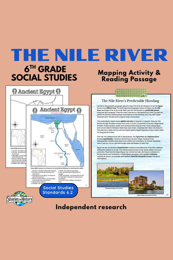
Help students understand how geography shaped ancient Egypt with this engaging Nile River reading and mapping activity!
This resource includes a clear, student-friendly informational passage explaining:
- The Nile River’s predictable flooding
- How fertile soil supported farming
- Why Egypt developed stability and unity
- Differences between Egypt and Mesopotamia
- Natural barriers (deserts, seas, terrain)
- Why Egyptian civilization lasted thousands of years
After reading, students complete a detailed Ancient Egypt map activity, labeling:
✔ Nile River & Nile Delta
✔ Upper and Lower Egypt
✔ Mediterranean Sea & Red Sea
✔ Western & Eastern Deserts
✔ Memphis & Thebes
✔ Giza & Valley of the Kings
✔ Nubia (Kush)
✔ Egypt on a map of Africa
An Answer Key is included for easy grading.
This lesson strengthens map skills, geographic literacy, and cause-and-effect understanding while reinforcing key 6th grade Ancient Egypt standards.
📄 What’s Included
- Informational Reading Passage
- Ancient Egypt Labeling Map Activity
- Student Instructions
- Completed Answer Key
- Print-and-go format
🎓 Grade Level
- Designed for 6th Grade World History
- Works well for Grades 5–7
- Ideal for classroom or homeschool use
📚 California History–Social Science Standards (Grade 6)
Aligned to:
6.2.1 – Describe the geographic features of ancient Egypt and the Nile River
6.2.2 – Explain how geography influenced settlement, economy, and political unity
6.2.3 – Understand how environmental factors shaped Egyptian civilization
This activity builds foundational geographic understanding essential for studying Egyptian government, religion, and culture.
This is an individual activity from my full-year Ancient Civilizations course. It's already included in the full-year course.
Share