Stories in History
Ancient Mesopotamia Map Activity- Fertile Crescent (6th Grade)
Ancient Mesopotamia Map Activity- Fertile Crescent (6th Grade)
Couldn't load pickup availability
Teach students how geography shaped one of the world’s first civilizations with this engaging Ancient Mesopotamia reading and Fertile Crescent map activity!
This resource includes a clear, student-friendly informational passage explaining:
- Why Mesopotamia is called the “Cradle of Civilization”
- The importance of the Tigris and Euphrates Rivers
- The Fertile Crescent
- Irrigation systems
- Flooding and environmental challenges
- Food surplus and specialization
- The growth of the first cities
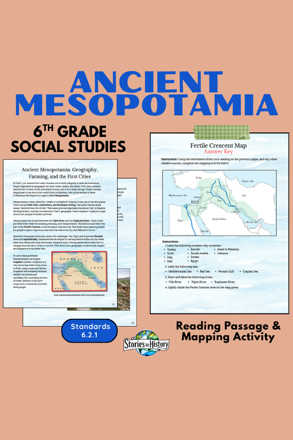
Students then apply what they’ve learned through a detailed mapping activity where they label:
✔ Modern-day countries
✔ Major rivers (Nile, Tigris, Euphrates)
✔ Important seas (Mediterranean, Red Sea, Persian Gulf, Caspian Sea)
✔ The Fertile Crescent region
An Answer Key is included for easy grading.
This lesson works perfectly as:
- A core Mesopotamia geography lesson
- A map skills reinforcement activity
- An interactive notebook page
- A review before assessments
📄 What’s Included
- Informational Reading Passage (Geography, Farming, First Cities)
- Fertile Crescent Map Activity
- Student Instructions Page
- Completed Answer Key
- Print-and-go format
🎓 Grade Level
- Designed for 6th Grade World History
- Works well for Grades 5–7
📚 California History–Social Science Standards (Grade 6)
6.2.1 – Locate and describe the geographic features of Mesopotamia, including the Fertile Crescent and river systems
6.2.2 – Explain how geography influenced settlement and development
6.2.4 – Understand the development of irrigation and agriculture
This activity reinforces geographic literacy and supports understanding of how environment influenced early civilization development.
This is an individual activity from my full-year Ancient Civilizations course. It's already included in the full-year course.
Share